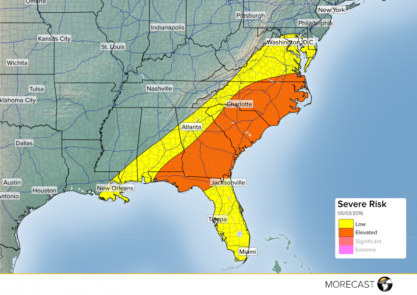
A cold front moving across the Southeast and mid-Atlantic Tuesday will bring a chance for severe weather during the afternoon and evening with hail and damaging wind gusts as the main threat.
As low pressure continues to move further off shore, a cold front will progress eastward towards the coast moving across the southeast and mid-Atlantic spurring thunderstorm development this afternoon for the Florida panhandle, southeast Alabama, Georgia, South Carolina, North Carolina, and southern Virginia. The strongest storms will develop along the cold front between I-85 and I-95 before moving east towards the coast this evening, impacting areas like Savannah, Georgia, Charleston, South Carolina and Raleigh, North Carolina. The main threats will be hail and damaging wind gusts. There will also be a chance for isolated flash flooding from heavy downpours, especially in the central Florida panhandle and southwest Georgia.
