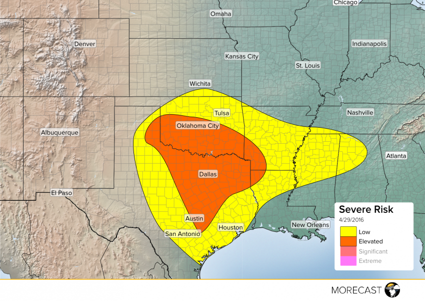
Another batch of severe weather is expected across the Southern Plains Friday. After the morning round of showers and thunderstorms wanes, stronger storms are likely to develop. The MORECAST team looks into what is expected as the afternoon progresses.
A developing area of low pressure in the High Plains will continue its march northeast during the day Friday. As it does, it will begin to pull a warm front that has been positioned roughly over the Red River during the morning further north allowing for very moist air to push in from the Gulf. With the front lifting north, conditions will become more and more unstable along the I-35 corridor from Austin through Oklahoma City. Main threats for these storms will be hail, wind, and isolated tornadoes. See the graphs below for more details on the threats for major metros in the area.
I-35 Corridor from North Texas Through Central Oklahoma
Central Texas


