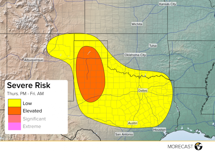
A storm system developing along the New Mexico/Oklahoma/Texas border to bring potentially severe storms to West Texas this afternoon and into the overnight.Storms beginning to fire in the Texas Panhandle will continue to development through the afternoon. As the evening progresses, an upper level low approaching the area will help develop a low pressure system at the surface along the New Mexico/Texas Border which could potentially bring another round of severe weather during the overnight hours. Biggest threats for the region appear to be large hail (potentially to 2″), strong winds gusting to near 65mph, and isolated tornadoes.
An additional area of concern lies along the I-35 stretch from Austin to Dallas. A boundary currently extends along an east-west line from just south of Austin to just north of Houston. As the evening progresses, this boundary will push north and allow for isolated thunderstorms to develop. Uncertainty exists on the potential for thunderstorm development, as well as the movement of these storms. The potential exists for these storms to produce hail to 1.75″, winds to 65mph, and isolated weak tornadoes. Due to these uncertainties, the area has been excluded from the “Elevated Threat” area, though it will be closely monitored and the MORECAST team will update you as needed.
UPDATE 8PM CDT:
Upon monitoring storm development in central Texas, above thinking still holds true but upgrading the threat from Low to Elevated seems unwarranted along the I-35 corridor. Storms should be isolated in nature, though they still possess a risk for strong winds, hail, as well as weak brief tornadoes.
