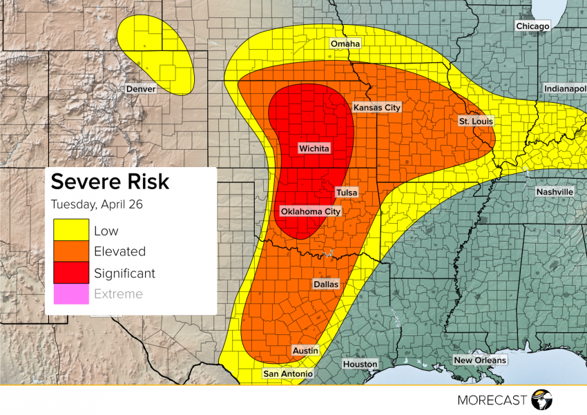
The most intense severe weather day of the season is looking increasing likely for portions of the Plains later Tuesday. A potent storm system moving out of the Rockies will tap into the rich moisture source of the Gulf of Mexico to allow thunderstorms to quickly develop along a line from Texas to Nebraska. Stronger storms across the Plains are likely to produce large hail, high winds, and tornadoes. For a more in-depth look into the causes of the outbreak, read the technical discussion below. Also if you can do so safely, be sure to upload your storm photos to your MORECAST app so we can show the world using social media.
Advanced Meteorological Discussion:
A currently closed off upper-level low situated over the Four Corners will function as the driving support for the activity over the next couple days. A horseshoe-shaped jet is stretched roughly from Arizona to the east of the front range of the Rockies with an embedded streak forecasted to eject into the Texas and Oklahoma Panhandles.
Closer to the surface, a warm front currently over northern Kansas will push into southern Nebraska and Iowa and a cold front will continue to develop across the High Plains before pushing eastward during the day. A somewhat weak 850 mb jet that develops during the early afternoon across east central Texas should strengthen into the evening through the Central Plains.
Low level moisture transport from the Gulf has been aiding in the development of a somewhat potent dryline extending from north-central Kansas through west Oklahoma and Texas with dewpoints of 68° in Frederick, Oklahoma and 28° in Amarillo about 150 miles further west. The dryline will strengthen during the afternoon and shift east toward the I-35 corridor into an area of high CAPE and strong wind shear. Due to low-level winds out of the southwest bringing hot, dry air from the deserts, a strong cap will be in place across the south-central Plains through midday Tuesday which will act like a lid to keep severe convection from firing. As the afternoon progresses, forcing from the upper level low and associated cold front to the west will help to erode the cap along the dryline. This is expected to trigger scattered areas of explosive thunderstorm development along and ahead of the dryline. Wind profiles support initialization of discrete supercells during the mid to late afternoon, favoring a more linear mode with embedded supercells as the evening progresses. The area for the best chance of thunderstorms extends from central Texas through southern Nebraska. The main hazards include hail up to 3” (potentially even higher), strong wind gusts up to 70 mph, localized flash flooding, and tornadoes with a threat for a few long-track tornadoes in the strongest storms that form along the I-35 corridor in Kansas.
To the south, uncertainty exists on the development and progression of thunderstorms. Most forcing should be further north, but wind and thermodynamic profiles of central Texas favor isolated supercell development. If any storm can get going near the Austin/San Antonio area then the potential exists for large hail to 2″, flash flooding, and possibly tornadoes.
Omaha
See Above for Details…
Kansas City
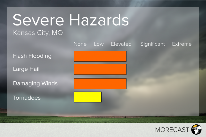 See Above for Details…
Topeka
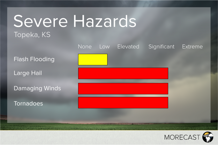 See Above for Details…
Wichita
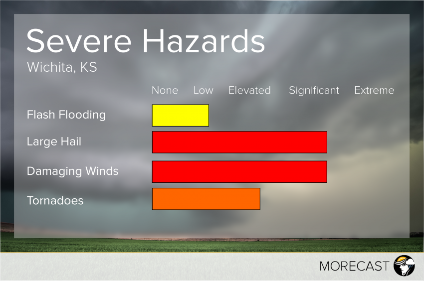 See Above for Details…
Oklahoma City
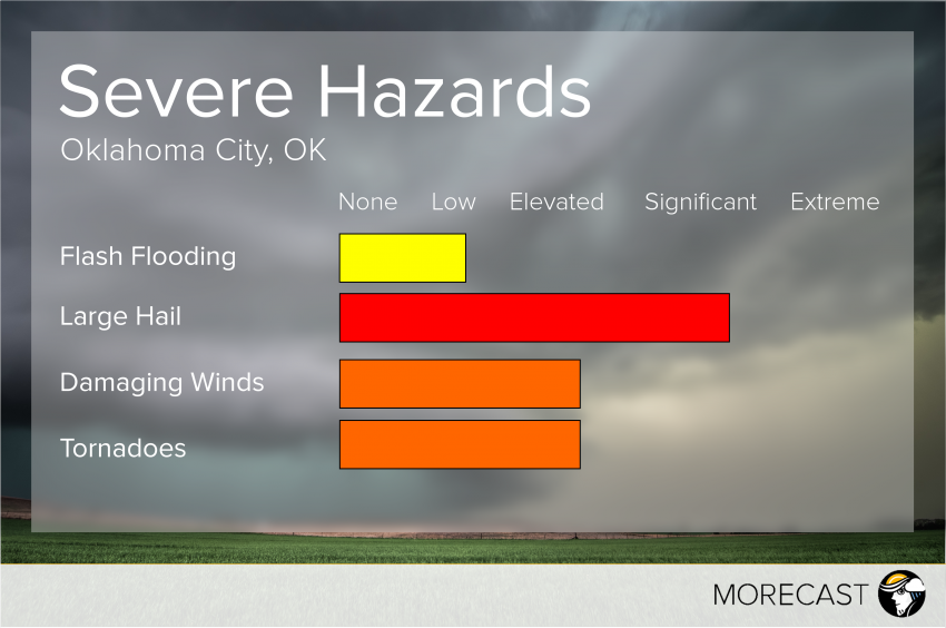 See Above for Details…
Dallas
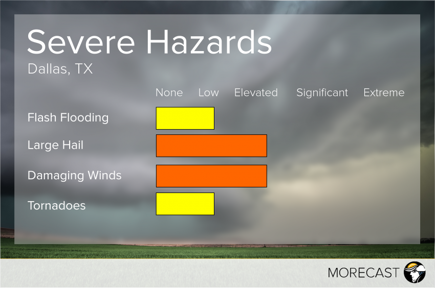 See Above for Details…
Austin
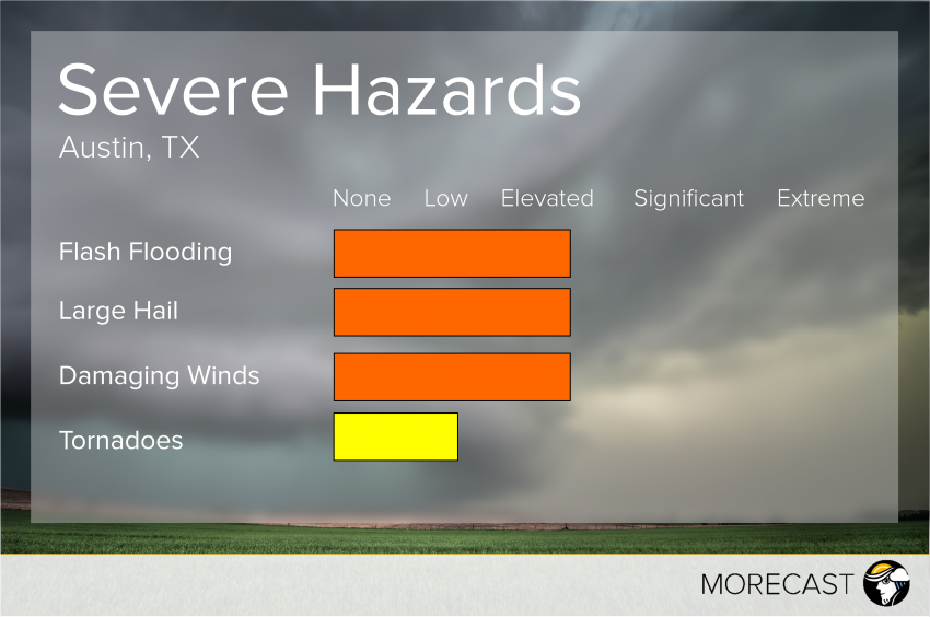 See Above for Details…
