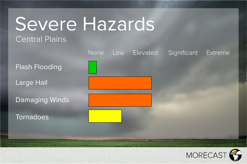
Severe weather ingredients will come together to form severe thunderstorms in the Central Plains on Sunday.
A dry line will push through the region Sunday afternoon and evening, bringing large hail, damaging winds and isolated tornadoes. With very cool air aloft, MORECAST meteorologists are monitoring central and eastern Kansas as well as southeast Nebraska for large hail up to the size of baseballs. Farther north and east into Iowa, Missouri and South Dakota, the large hail potential will diminish slightly, meaning damaging winds will be the primary threat. A couple tornadoes will also be possible from these storms.
In terms of timing, activity will kick off in central Kansas and Nebraska Sunday afternoon, moving eastward toward the Missouri River Sunday evening. As storms head into Iowa and Missouri, they are expected to weaken and diminish, though some moderate to heavy rain may linger into the overnight.

