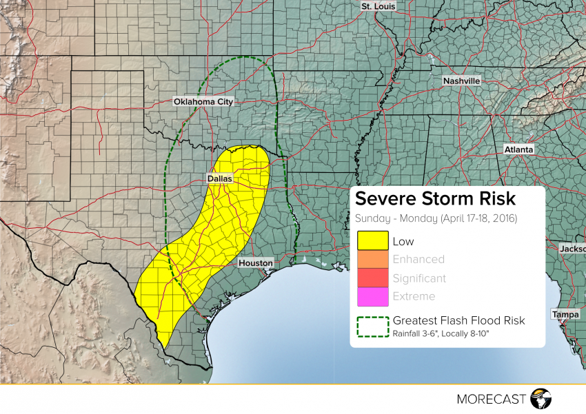
Hail in excess of 2 inches in diameter was produced by storms in western Texas Saturday. High winds and even a couple of tornadoes were reported as well. Sunday’s severe weather shifts into central and eastern Texas, where similar threats and flash flooding look likely.
Scattered severe storms will develop Sunday afternoon along a boundary draped from central Oklahoma through central Texas. With plenty of heat and moisture to work with, storms will be capable of producing high winds, large hail, and a few tornadoes through Sunday night. This boundary will stall across the region through Monday, allowing multiple rounds of rain and storms to occur across the same locations. This will bring an enhanced flooding risk through Monday night. Many locations through eastern Texas and eastern Oklahoma will receive 3-6 inches of rain, with localized areas seeing 8-10 inches. Watch out for flash flooding on roadways. Severe storms on Monday will be isolated and confined mainly to southern Texas.
We’ll continue to monitor this dangerous situation and issue updates as needed for the MORECAST app as well as Facebook and Twitter!
