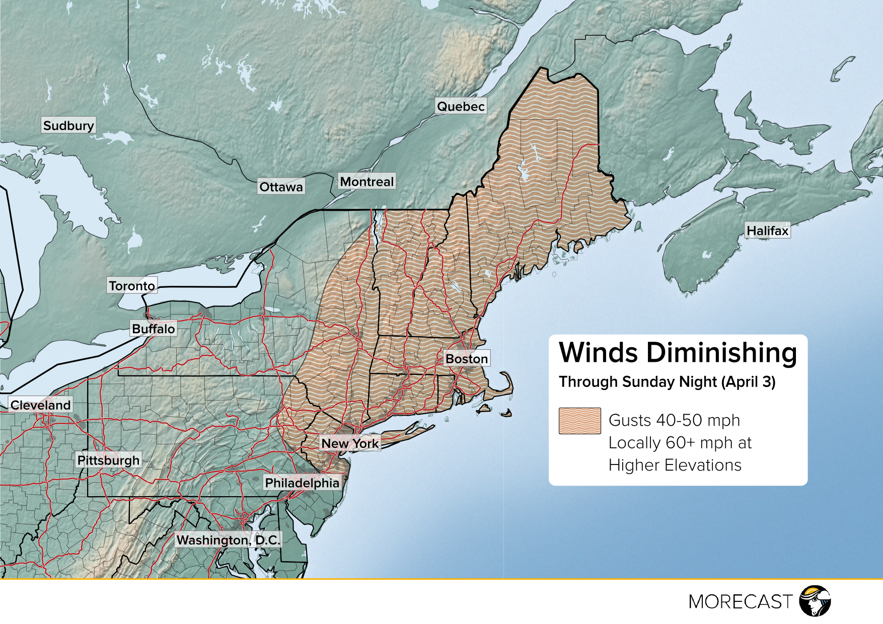
High winds have caused numerous trees to come down with scattered power outages across the Northeast overnight and this morning. Even as these winds slowly diminish through this evening, another small but potent disturbance will pass through overnight into Monday, combining with unseasonably frigid air to produce significant snow accumulations.
Many areas saw gusts this morning upwards of 50 mph, including a peak of 64 mph at JFK International, leading to numerous trees and powerlines down, even some damage to buildings. Mountain peaks have seen much higher gusts, up to 86 mph at Mt. Washington. The system responsible for these winds is starting to move off the coast, and winds should slowly diminish this afternoon. However, potentially damaging wind gusts to 50 mph will continue across much of New England, with gusts to 60 mph or higher in the mountains.
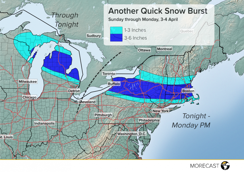
These strong west to northwest winds are helping to usher in a winter-like cold air mass with temperatures far below normal for early April. Another clipper-type disturbance will move from the Great Lakes this afternoon across the Northeast tonight and Monday, producing a narrow band of light to moderate snowfall (see graphic at top). Accumulations of 1-3 inches will be common, with a band of 3-6 inch accumulations affecting north-central Lower Michigan, southern New York, extreme northern Pennsylvania, and interior southern New England. The 3-6 inch band will affect cities like Buffalo, New York and Boston, Massachusetts. A few high-elevation spots in southern New York could see isolated totals up to eight inches.
Temperatures in the wake of this last snow band will fall well down into the teens across much of the Northeast both Monday and Tuesday night, except along the coast, with single digit lows probable over northern New England. For the latest temperature and precipitation forecasts, us the MORECAST app! We’ll also continue to send updates to our Facebook and Twitter feeds as necessary.