Updated: March 31 @ 9:30am CT.
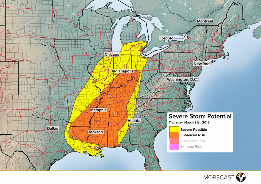
After numerous reports of hail, wind, and even a few tornadoes across central portions of the country on Wednesday, another round of severe weather is expected Thursday from the Lower and Middle Mississippi Valleys, eastward through the Ohio and Tennessee Valleys and Central Gulf Coast region. Destructive winds, large hail, and a few tornadoes will occur.
The best chance for severe activity on Thursday is expected within a swath from northern Louisiana and portions of the Gulf Coast, northward through Memphis and Nashville, Tennessee to Indianapolis, Indiana. In this corridor, dangerous high winds will gust to 80 mph within the strongest storms, combined with hail upwards of 2 inches in diameter. Isolated tornadoes will also be a hazard along with spotty flash flooding. Regions bracketing the “Severe Possible” risk area, including the southern Great Lakes and much of the Central Gulf Coast, will see a more isolated, random risk of briefly strong to severe storms. The time frame for the greatest severe threat is from late morning through early evening on Thursday.
If you live in the affected areas, pay very close attention to your weather radio or local news stations through Thursday evening. MORECAST meteorologists will continue to track this severe weather event and issue timely updates on our Facebook and Twitter pages.
