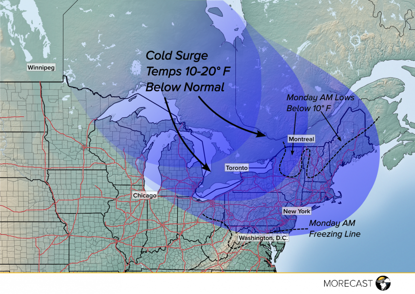
A surge of unseasonably cold air will move across the Great Lakes into the Northeast from Sunday through Tuesday, bringing temperatures as much as 20 degrees below normal to an area that’s generally enjoyed quite mild conditions in the past few months. The coldest morning should be Monday morning, but well below normal temps will linger through Tuesday before quickly moderating.
This air mass will bring with it widespread temperatures at least 10 degrees below normal with some locations at times 20 degrees or more below normal. Monday morning lows will fall to near freezing from Washington, DC to Atlantic City, New Jersey, into the middle 20s to near 30 degrees in Boston and New York City, into the teens over interior New England, and even down into the single digits for the mountains. Temperatures near zero aren’t out of the question in sheltered, colder elevated valleys. These frigid temperatures will threaten early-blooming plants. There will also be a chance for some light snowfall over interior New England, although exact details on amounts and locations affected will be hammered out in the coming days. Depend on the MORECAST app for pinpoint temperature and precipitation forecasts.
