Cold front developing in the center of the country Easter morning will spark thunderstorms during the afternoon. MORECAST looks into what you can expect in your neck of the woods.
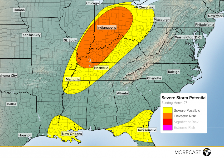
Low pressure currently centered over eastern Illinois will continue marching east Sunday afternoon spawning thunderstorm activity near and along the cold front extending from it. Some of the storms in Kentucky and Indiana are the most likely area to see severe storms with damaging winds and hail being the main threats. Moving further south into Kentucky and Tennessee, hail potential ramps up but storm development will be much more limited. Storms will likely continue into Ohio after sunset Sunday evening with a continuing but more limited chance for strong winds and widely brief and isolated tornadoes.
Enhanced Potential Area
Storms likely to begin development around or a little before 5pm ET Sunday in Indiana and Kentucky. They will march northeastward through the evening bringing a chance of hail and damaging winds. An isolated short-lived tornado is also possible in stronger storms embedded within the line.
Ohio
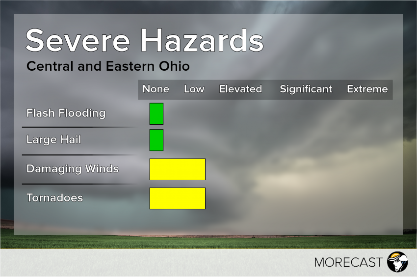
 Storms should reach the Indiana-Ohio border by around 8pm ET Sunday evening and continue into central and eastern Ohio during the late evening and overnight hours. These storms will lose the heating of the day and will likely be less severe than storms to the west, but strong winds are still possible as is an isolated short-lived tornado.
Tennessee and Mississippi
 Being further from the center of the low, storms will have a harder time intensifying in Middle and West Tennessee along with northern Mississippi even as the cold front passes through. The primary threat for any storm that does form will be hail and potentially severe winds. Tornadoes are not likely with these storms.
Florida and South Georgia
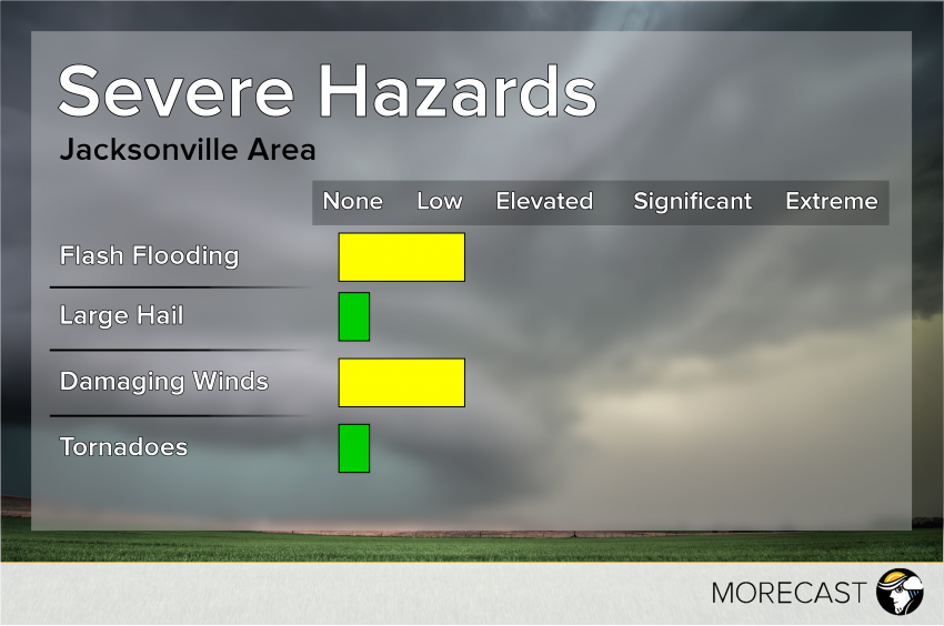
Rain has persisted through the Deep South for much of Sunday along a stationary front. Ample moisture will allow for flash flooding along the Gulf and Atlantic Coasts as well as a few storms bringing strong winds.


