Record high temperatures, blizzards that shut down major cities, and well above normal rainfall amounts in the Southeast have made for an impressive winter this year. MORECAST meteorologists take a look back at this winter season and recap the major weather events of the past few months.
Temperatures
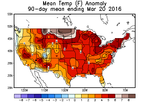
Across almost the entire country, Americans experienced an unusually warm winter this year. In fact, the national average temperature for this winter was the warmest ever recorded, according to the National Climatic Data Center (NCDC). Preseason predictions of warmer-than-normal temperatures, especially across the northern tier, turned out to be very accurate. For example, Montana, South Dakota and Minnesota experienced the biggest departure from normal with mean temperatures more than 8 degrees fahrenheit above average from December to March. The Great Lakes region had such abnormal warmth this year that only a small portion of the lakes were covered in ice, with a maximum ice coverage of 34% in February. This is in stark contrast with the past two winters when ice coverage was over 85%. The Northeast also saw abnormally high temperatures, with the most notable event during the holidays when several locations in the state of New York enjoyed Christmas morning temperatures in the 60’s. Only a small fraction of the country experienced temperatures slightly below average, such as the western coast of Oregon, southeast Utah and southwest Arizona.
Precipitation
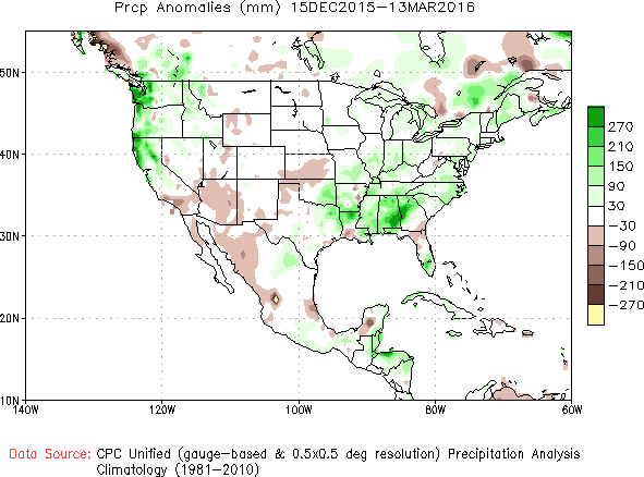
With an El Niño pattern, southern California residents were expecting above normal precipitation amounts in the drought stricken region. However, a majority of the area saw little to no drought relief this winter with precipitation amounts slightly lower than average over the past three months. Northern California, Oregon, and Washington experienced quite the opposite, with well above average precipitation amounts due to several storm systems that brought heavy rain to these states. Residents in the Southeast also experienced a wet winter with higher than average precipitation amounts from December through March.
Snow
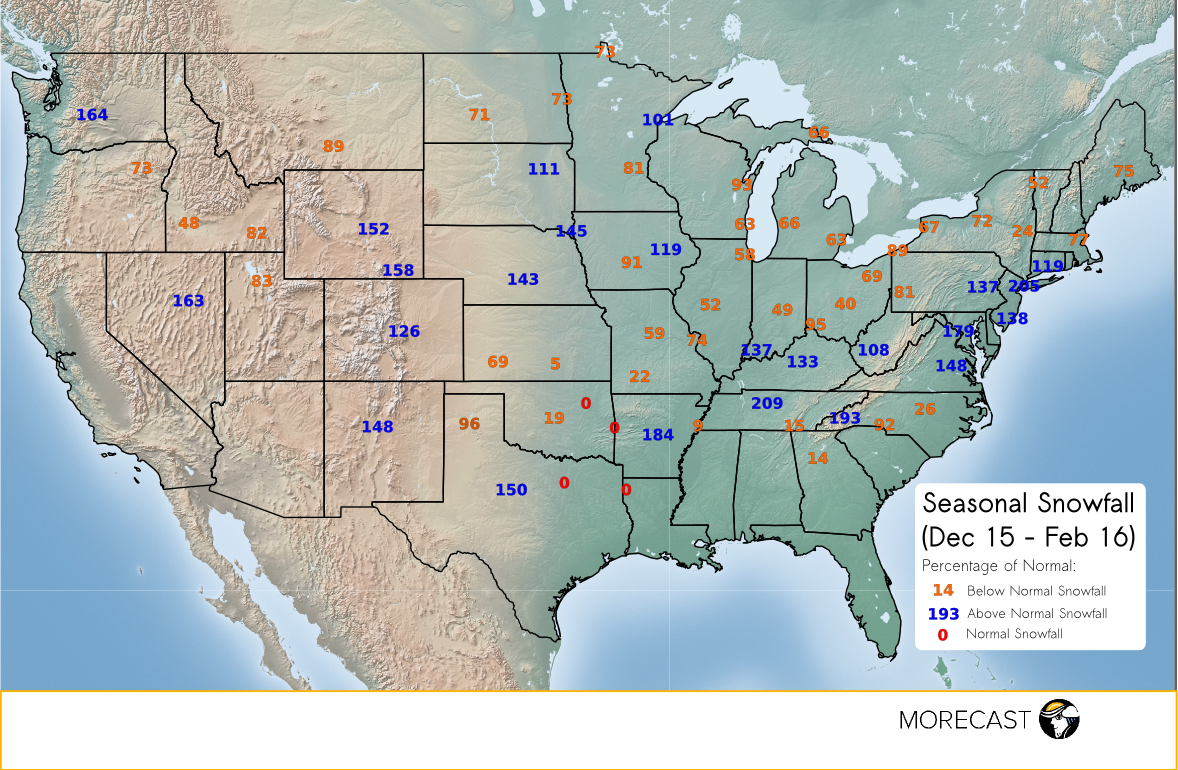
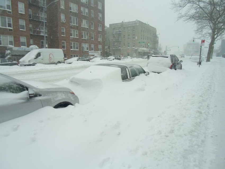
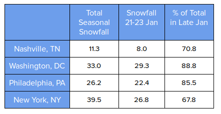
The tracks of major snowstorms are easily spotted when looking at what portions of the country had above normal snowfall amounts. For example, the blizzard that broke records across the Mid-Atlantic and Northeast on January 23rd was responsible for a majority of several cities’ total snowfall, causing above normal snowfall amounts for much of that region.
 Other notable areas of above normal snowfall amounts were the Rocky Mountains, Missouri Valley and Tennessee Valley. The Midwest saw below average snowfall amounts, as expected during an El Nino year and likely due to the warmer than average temperatures this winter. In the Sierra mountains, snow amounts varied in either direction with near normal snowfall in the northern sections, but below normal to the south. The far Northeast saw below normal snow amounts, greatly affecting many ski resorts during their peak seasons.