Low pressure developing over the central U.S. will move into the upper Midwest Thursday. The track of the storm continues to become more clear, and MORECAST is predicting a significant snowfall for some communities from Iowa to Michigan.
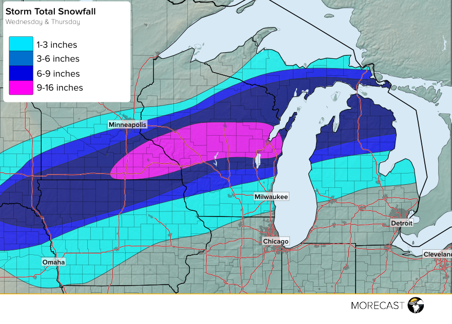
As of Wednesday afternoon light snow has started to break out across southern Minnesota, central Wisconsin, and central Michigan. As the low pressure system continues to intensify across the central Plains, an abundance of moisture will stream northward from the Gulf of Mexico and run into the colder air farther north bringing moderate to heavy snow overnight into Thursday morning. The heaviest snow is expected from southern Minnesota into central Wisconsin where in excess of 10 inches or more is likely. Strong winds will also cause blowing and drifting making travel difficult and dangerous. Along the southern periphery of the snow, a mixture of freezing rain and sleet is likely for a time overnight and early Thursday across southern Wisconsin from Madison to near Milwaukee stretching east into central Michigan. Farther south toward the Chicago and Detroit metropolitan areas precipitation should fall mainly as rain. MORECAST forecasters are closely monitoring the situation and will keep you up to date as the storm evolves.