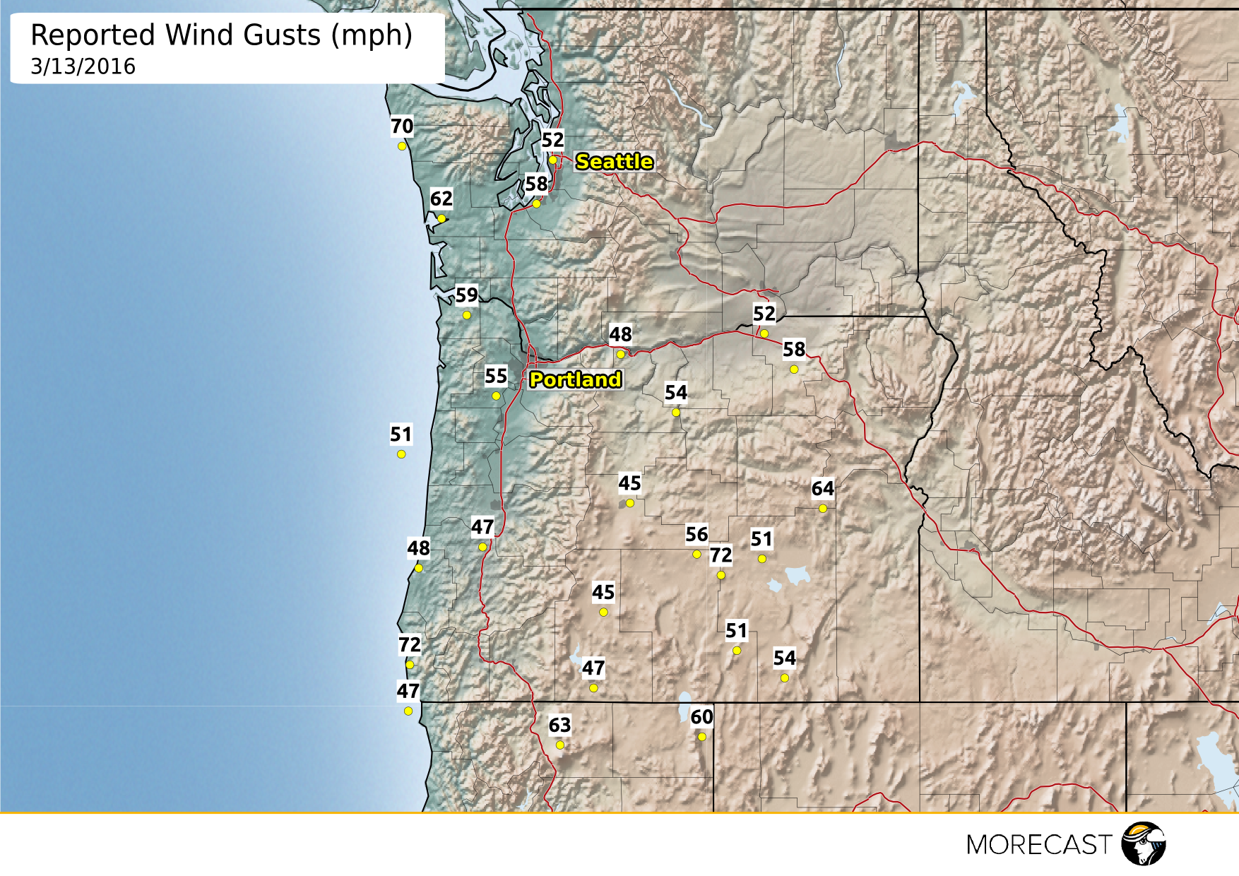
Strong wind gusts across the Northwest have been ongoing since this morning and will continue into the evening hours as a strong low pressure system pushes through the area. Mountain peaks have also been seeing notable gusts with 104 mph gust reported at Brush Mountain, CA and a 88 mph gust at Squaw Peak, OR. Damage has been reported due to high winds and has caused power outages across Oregon, Washington, and even on Vancouver Island.
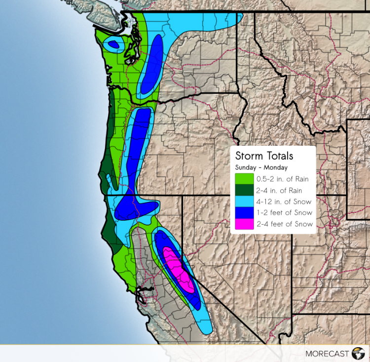
A potent low pressure system will push towards the Northwest Sunday morning before moving into British Columbia. As the system moves closer to shore, rain and wind will move inland with rain amounts ranging 0.5 to 4 inches with the heaviest amounts along the coast. This system will also cause heavy snow in the Cascades and Sierra Nevada mountain ranges. The heaviest snow will be likely in the Sierra’s, with 1-4 ft possible above 5000 feet. Tahoe City can expect to see at least 1 foot of snow before snow tapers off Monday afternoon. Elsewhere, snow amounts will range 6 inches to 2 feet with snow levels mainly above 4000 feet.
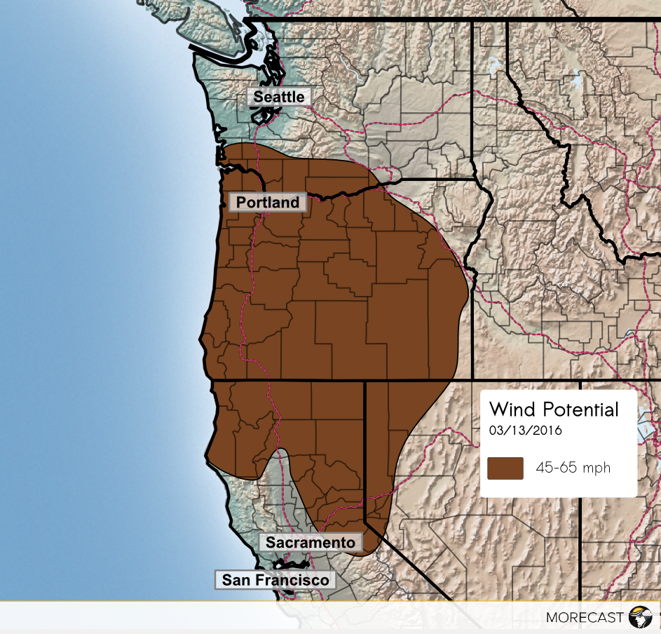
This system will cause winds to flow perpendicular to the coast throughout the morning hours which will bring gusty winds, 45-65 mph.Winds will move further inland throughout the morning and afternoon, affecting most of the state of Oregon, and parts of California, Washington, and Nevada before diminishing around 7pm PST. Northern Washington, including Seattle, will see breezy winds as well, with gusts likely to 40 mph and isolated gusts 50+ mph.
Expect travel impacts due to gusty winds, snow along mountain passes, and potential flooding. Gusty winds may cause air travel delays in Seattle and Portland and slick roads will likely cause traffic. Isolated power outages are also possible due to the high winds, especially near the coast and mountains.