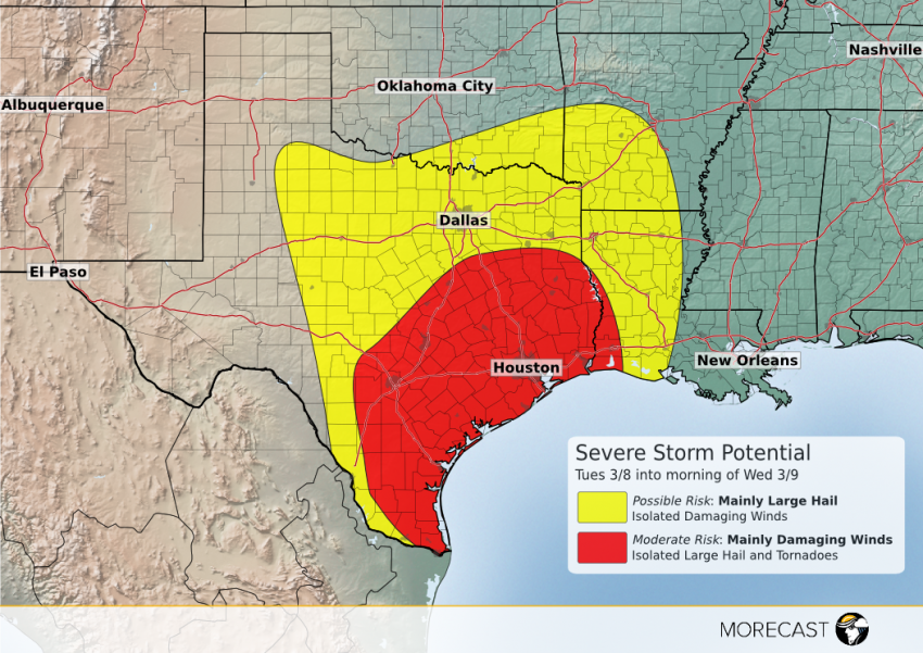
Scattered severe storms will develop on Tuesday afternoon near the US – Mexico border, consolidating into a dangerous squall line Tuesday evening as it moves east or northeast across southern Texas. Other, more isolated severe storms could affect areas further north.
An upper low will dig unusually far to the south into north-central Mexico by Tuesday, providing the upper level wind energy which will combine with Gulf moisture streaming into Texas to create a favorable severe storm environment. The most widespread threat will be high winds as the storms sprint across southern Texas Tuesday evening, approaching Houston by the early morning hours on Wednesday. Isolated cases of large hail and tornadoes will also occur. Hail will be the main threat to the north in the possible risk area, including the Dallas-Ft. Worth metro. The danger from rapidly-moving severe storms will increase after dark. Stay up on the latest forecast details using the MORECAST app. We’ll post updates through our Facebook and Twitter pages as needed over the next few days!
