The well advertised arctic intrusion into the Northeast U.S. broke many temperature records Sunday morning, including in Watertown, New York which dropped to a frigid -37°F shattering the old record of -30°F set in 1979. In total, seventeen states east of the Mississippi River from Minnesota to Virginia to Maine had at least one observation with a temperature below zero early Sunday. Every state in the Northeast had temperatures drop below zero Sunday morning with many locations falling to -10°F or lower.

In New York City, a one hundred year old temperature record fell when Central Park plunged to low of -1°F breaking the previous low temperature record of +2°F set in 1916. Furthermore, Sunday morning’s low of -1°F was the first time Central Park dropped below zero since January 19th 1994.
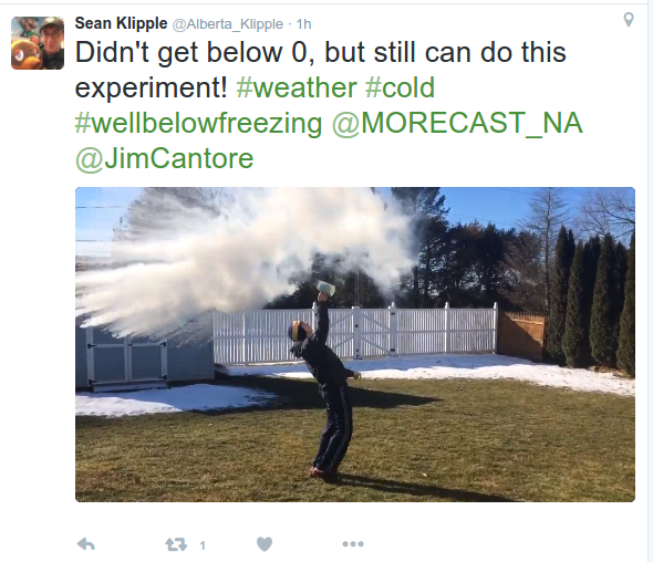
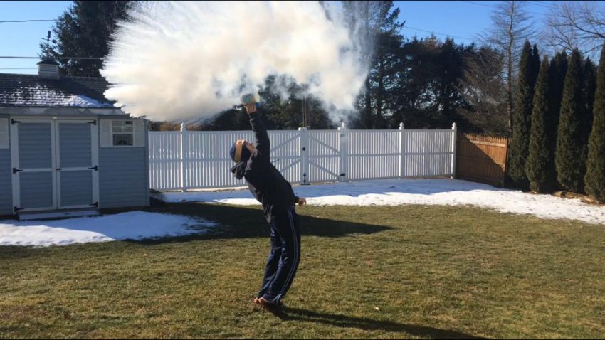
Temperatures across the Northeast were so cold that some hardy souls braved the elements to try the boiling water to “snow” experiment. MORECAST meteorologists in New York City were among those that ventured outside to give the experiment a try.
Even in Pennsylvania, where temperatures were not quite as frigid as other states in the Northeast, it was still cold enough to watch boiling water turn to “snow” almost instantly.

The polar plunge that dropped into the Northeast this weekend is due to a deep dip in the jet stream, something the Eastern United States has not seen much of this winter.
“The kind of amplified pattern that typically results in prolonged cold snaps in the Eastern U.S. has been largely absent this winter,” says MORECAST senior forecaster Andrew Crouch. “Partly thanks to the strong El Nino, we’ve seen mostly ‘zonal’ flow, meaning warm air has remained entrenched across much of the continental U.S. with cold air bottled up in the northern latitudes.”
This highly amplified pattern has led to several days worth of warm, dry weather over the West. The Desert Southwest is in the middle of stretch of days with temperatures reaching well up into the 80s. Warm air has surged as far north as Alberta, Canada, with high temperatures in Calgary having reached 61 degrees on Tuesday, shattering the previous record for the day that had stood for 90 years.
In the East, February temperatures started out relatively mild, however, the current cold snap has brought monthly temperature departures closer to average. The amplified jet stream pattern has disrupted the flow of the polar vortex, the cyclonic swirl of winds that wraps around the Arctic all winter long and ordinarily bottles cold air up in the northern latitudes. The disruption of the flow across the arctic was strong enough to dislodge a chunk of frigid air from the Arctic source region and send it plunging south, a situation often associated with record-breaking cold temperatures in the East.
Along with the frigid temperatures are blustery winds which only add to the misery, with gusts of 15-30 mph driving wind chills down into dangerous ranges as low minus 50 degrees. Atop the Northeast’s highest mountain, Mt. Washington, New Hampshire, wind gusts have peaked as high as 78 mph Sunday morning with wind chills as low -78°F.
Keep up with expected temperatures and other forecast details using your MORECAST app!

