One of the strongest, if not the strongest, El Ninos on record is continuing right now in the Pacific Ocean, and it will play a significant role in the upcoming winter here in the United States. El Nino refers to the warming of waters in the eastern equatorial Pacific Ocean, causing changes to weather patterns around the world. We’ve already discussed how this winter’s El Nino could impact drought-stricken California. Here’s how El Nino may impact the eastern half of the United States over the next three to four months:
The Southeast & Gulf Coast
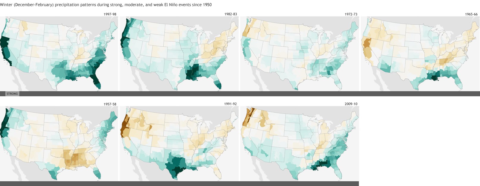
There is a high probability it will be a wet and soggy winter. El Nino causes the subtropical jet stream, which is normally found over Central America during the winter, northward. This allows lots of Pacific moisture to flow across the southern United States. Six of the seven strongest El Ninos on record have all led to above average winter precipitation in the south (Figure 1). The extra moisture also increases the threat for severe thunderstorms during the winter months. November has already shown above normal rain amounts, especially for Texas and Louisiana. Along with an umbrella, folks down south will also need the long sleeves, as the extra precip and clouds will likely lead to below average temperatures for most of the winter.
Figure 1 (click to enlarge): A look at precipitation anomalies across the U.S. during the winter months aligning with the seven strongest El Ninos on record (dating back to 1950). With the exception of 1957-58, the winters brought above average precipitation to Gulf Coast states. Mid Atlantic states also tend to receive more precipitation compared to normal in most strong El Ninos, but not all. Meanwhile, the Great Lakes and Ohio Valley usually see less precipitation compared to average. New England is more of a toss up, with a mix of above average and below average precipitation winters during strong El Ninos.
The East Coast
The extra moisture down south is also expected to reach much of the east coast, where a wetter than normal winter is also expected for the Mid Atlantic and southern New England. But what type of precipitation is a little bit trickier. Overall, it looks like most of the Northeast and Mid Atlantic will experience above average temperatures, meaning some storms could be rain makers instead of snow. However, other factors like the Arctic Oscillation and the North Atlantic Oscillation will also impact temperature trends. While overall snow may come in below average in many places, the possibility exists for a brief cold snap to combine with the extra moisture to form a massive nor’easter or blizzard. In fact, one of the biggest blizzards to strike the I-95 corridor from Washington D.C. to New York City occurred in February of 1983, also during a strong El Nino. Many places picked up 20-30” of snow in that storm. But it’s all dependent on that cold air. During another strong El Nino winter of 1997-98, very little snow fell in places such as Baltimore and Philadelphia.
The Midwest and Northern Plains
After some brutally cold and snowy winters the past couple years, Midwestern states and the Northern Plains can expect a milder winter with temperatures overall expected to be above average with below average precipitation (i.e. snow). The end of October and beginning of November set numerous records for high temperatures across the Great Lakes. But don’t pack away the shovels just yet. Even though below average snowfall is expected, that doesn’t mean zero snow, as those in the Chicago and Milwaukee areas have already experienced with a pre-Thanksgiving snowstorm. And even in if temperatures end up above average overall, a couple cold outbreaks are still possible, but they likely won’t last as long or be as sever as the past few winters.
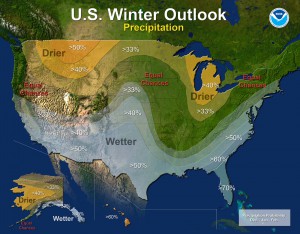
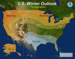
Figure 2: Official winter outlook for the United States issued by NOAA, echoing a common result during an El Nino. Note that the outlook uses probabilities to denote chances of above average, below average or average outcomes. Equal chances means the probability is the same (33%) for either of those three outcomes.
It is important to note that these are trends based on past El Ninos, and day to day fluctuations are likely. Also, there have only been five strong El Ninos of similar magnitude to the current one on record, which is a fairly small sample size. El Nino offers forecasters some insight on how things may pan out over the next three to four months, but the atmosphere is complicated and chaotic, and can sometimes throw a wrench into a seasonal forecast. So make sure to check out Morecast for your daily weather forecast for the very latest information.


