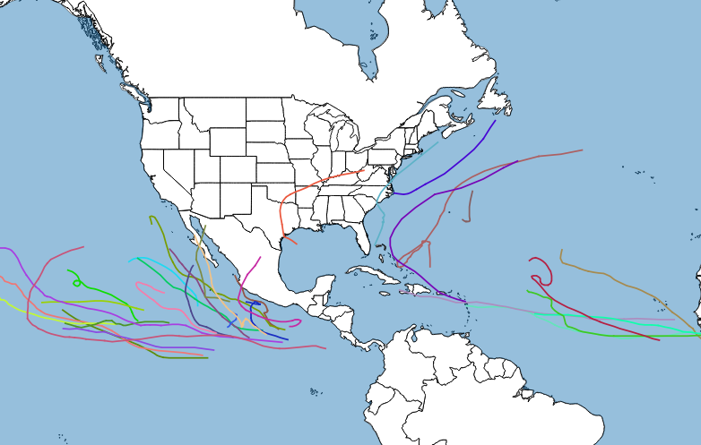
Pre-season predictions made in the spring and summer for the 2015 Atlantic Basin hurricane season analyzed cooler-than-normal ocean waters and the strengthening El Nino to generally forecast below-average tropical cyclone activity. El Nino typically strengthens the tropical jet stream, resulting in more disruptive wind shear across the Atlantic basin, unhealthy to potential tropical cyclones. The Atlantic season started with a minor bang, though, when Ana formed in early May and became the earliest recorded tropical storm to make a landfall on the Eastern Seaboard as it came ashore near Myrtle Beach, SC early on 10-May.
Ida became the ninth named storm of the season on 18-September, barely past the halfway point of the season, but from then on there were only two more named storms. In the end, predictions of a below-normal season proved correct. There were only two hurricanes that achieved “major” status (Category 3 on the Saffir-Simpson scale), and one of those, Danny, did so for only six hours. The final tallies of 11 named storms and 4 hurricanes were likewise below average, as was the count of Accumulated Cyclone Energy (ACE), the measure of total wind energy generated by all the cyclones in a season used to compare aggregate activity from one season to another.
The most noteworthy Atlantic cyclone by far was Joaquin, although that was almost as much for the hype that was generated by the threat it briefly posed to the US East Coast as the actual damage that it caused. Joaquin developed in an area of weak steering flow and favorable conditions for intensification off the Southeast coast about midway between the Bahamas and Bermuda in late September, reaching hurricane status on 29-September and then major hurricane status on 30-September as it drifted into the Bahamas. The storm moved achingly slowly through the Bahamas, pounding the islands with days of high winds and storm surge flooding. In addition, the storm caused the wreck of the cargo ship El Faro and the loss of all 33 crew members onboard.
At the same time, forecast models were having an extremely difficult time deciding what Joaquin was going to do next, particularly how it would interact with a strong upper-level storm system moving into the Eastern US. Some model solutions suggested the kind of doomsday “perfect storm” scenario that led to Hurricane Sandy devastating portions of the Northeast in October 2012. Fortunately, after some hesitation Joaquin ultimately turned out to sea, skirting past Bermuda before moving across the open Atlantic and sparing the major land masses a direct hit.
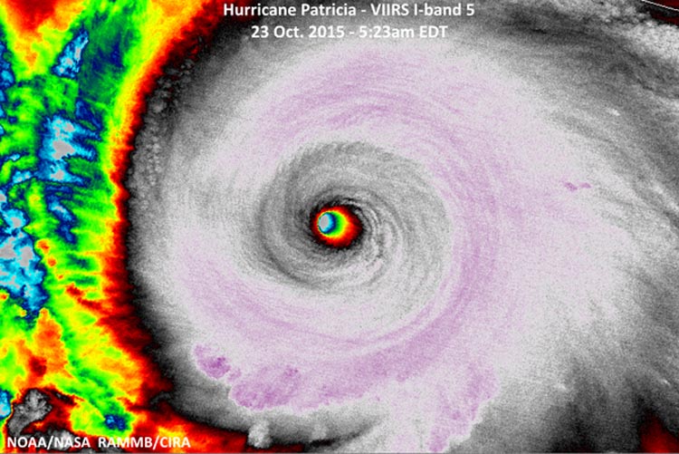
It was a much busier season in the eastern Pacific basin, however, surpassing even the forecasts that called for above-normal activity in a strong El Nino pattern. Warmer-than-normal sea surface temperatures dominated the Pacific basin as a result of El Nino, providing the ideal environment for cyclone formation and intensification. Currently the season ranks as second busiest in terms of total major hurricanes (10) and ACE count (267) with Tropical Storm Rick still active and another week left before the official end of the season. The headliner was Patricia, a monster in late October that established new world records for rate of intensification and highest wind speed. Fortunately it moved into a sparsely populated area of southwest Mexico and did relatively little damage. Several hurricanes at least temporarily threatened the Hawaiian Islands at different times during the season, although none actually made a direct, significant impact.
