Flying into the eye of Hurricane Patricia aboard the Lockhead WP-3D
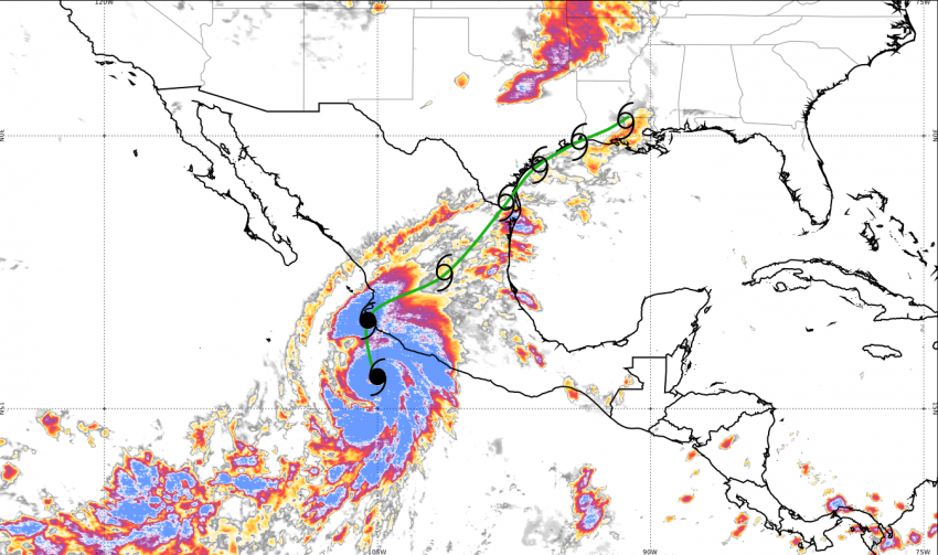
With a minimum central pressure of 878.4 mb, Hurricane Patricia will go into the record books as the most intense storm ever recorded in the Western Hemisphere. It is only the second time that such a powerful storm has struck the Mexican Pacific coast. The last time this happened was in 1959, when almost 2000 people perished in a devastating category 5 hurricane.
Accurate forecasts are vital
Forecasting the exact track and strength of a hurricane is complicated, but essential to help people in potentially affected areas take precautions as early as possible. The earlier the precise track and intensity can be determined, the better the chances are to avoid disasters such as in the 1950s.
This is one of the primary reasons why huge investments have been made to improve tropical storm observations and forecasts. Besides satellite imagery and high-resolution modeling, getting accurate data from within the storm system itself is a crucial part in the forecasting and warning process.
Hurricane Hunters
Since 1943, the US National Oceanic and Atmospheric Administration (NOAA) has been using two specially equipped Lockheed P-3 research aircraft to fly into and through hurricanes, including the eye. Four powerful Allison-Turboprob-engines keep the airplane airborne even through the wildest conditions of the eyewall, the most intense part of a tropical cyclone. It was also a P-3 that flew through the record-breaking storm Patricia, providing important real-time data.
State-of-the-art technology
The Lockheed P-3 aircraft are equipped to sample all relevant meteorological parameters. Among the onboard instrumentation are several C-band and X-band weather radars. The planes have not been specially reinforced for the hurricane operations, but the decks have been amended to better withstand the extreme forces during flights in the storm´s circulation.
Blind flight into the center
A large part of the flight path consists of flying through a wall of thick cloud, blinding rain and zero-visibility conditions. However, once the aircraft reaches the center of the ferocious storm, everything suddenly becomes calm.
Within seconds, the dense clouds give way to bright sunshine, often with blue skies overhead, while a huge, almost vertical, wall of dark clouds surround the scene. This is because air within the eye of the storm is sinking and warming, thus drying the air. A few minutes later, the airplane enters the other side of the eyewall and the blind flight continues. Within the calm eye as well as during the transect through the eyewall, special sondes are being dropped from the plane which gather very important data on the strength and evolution of the storm, crucial for forecasts and warnings by the National Hurricane Center (NHC). These critical maneuvers can be repeated as often as necessary since there is enough fuel to be in the air for up to 12 hours.
Risky endeavor
Even with the latest technology, every single flight through a hurricane remains a delicate and hazardous procedure, a fact well-known by the pilots and scientists. Nevertheless, these risky reconnaissance flights are extremely valuable as the data from these missions enable forecasters to produce more accurate and timely weather warnings. Even though this does not prevent the damage a hurricane may bring, its effects can at least be mitigated and, more importantly, lives can be saved.
