Hoar Frost (Source: National Weather Service)
Autumn has arrived in the United States. As it does so, leaves across the northern two thirds of the country will begin to change color, and temperatures will start their gradual decline from their summertime peaks. And as temperatures start to drop to freezing and below (32°F/0°C), many of us will start waking up to frost on our car windshields, lawns, and gardens.
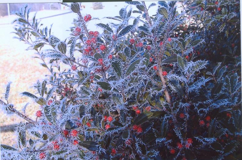
Frost usually forms through a process called deposition. When the atmosphere cools off, it is unable to hold as much water vapor, a gas, compared to a warmer atmosphere. When the temperature drops below freezing and there is enough water vapor–a gas–present in the atmosphere, the water vapor changes into ice crystals instantly on a surface (grass, trees, windshields), skipping the liquid phase altogether. This ice that forms is sometimes referred to as hoar frost, which produces a shiny white coating of ice, and when thick enough can sometimes look like snow has fallen. The other main type of frost is ‘frozen dew’. This frost starts off as regular dew that forms with temperatures above freezing. But if temperatures continue to drop below freezing during the night, then the dew can freeze, forming a frost.
Based on climatology, the first frosts of the season are possible any day now across the intermountain west, Northern Plains, northern Great Lakes and northern New England, where temperatures typically drop below freezing for the first time starting in September. Places in the central Plains, Ohio and Tennessee Valleys, Mid Atlantic and southern New England usually experience their first freeze in October, while it takes until November or longer for colder conditions to reach the deep south and much of California, as you would expect. It usually takes a big plunge of cold, arctic air in the middle of winter to reach places along the Gulf Coast and northern Florida. But as the map shows, there are very few places in the U.S. that usually escape subfreezing temperatures, except southern California and southern Florida.
Temperature data collected over 30 years shows the median first date for temperatures dropping below 32°F in the continental U.S. Note, these are median dates, taking the middle of the earliest and latest dates of the first freeze (Source: National Weather Service)
When frost forms, it can damage or kill sensitive plants and crops, which is why gardeners and farmers have to keep a close eye on the first freeze if they still have sensitive vegetation outside. The National Weather Service typically issues Frost Advisories the first few times temperatures drop below 36°F in an area. If you’re wondering why forecasters would issue an advisory even if temperatures are above freezing, you have to remember that air temperature is measured 6.5 feet above ground. It is possible for the temperature right above the ground (just a few centimeters) to be colder than the measured air temperature, especially on clear and calm nights. And when the air just above the ground cools to freezing or below, frost is possible if there is enough moisture present. In fact, to protect plants, some farmers use large, outdoor fans on cold nights because it helps mix down slightly warmer air just a few feet above ground all the way to the surface, preventing frost formation.
Meanwhile, the National Weather Service will issue Hard Freeze Warnings when temperatures are expected to drop to 28°F or lower. Hard freezes tend to wipe out even tougher plants that can tolerate some frost with temperatures around freezing, and usually marks the end of the growing season. The first hard freeze typically occurs a couple weeks after the first freeze/frost. In most cases after the first hard freeze in a given location, the National Weather Service no longer issues Frost or Freeze advisories for the remainder of the cold season for that area.