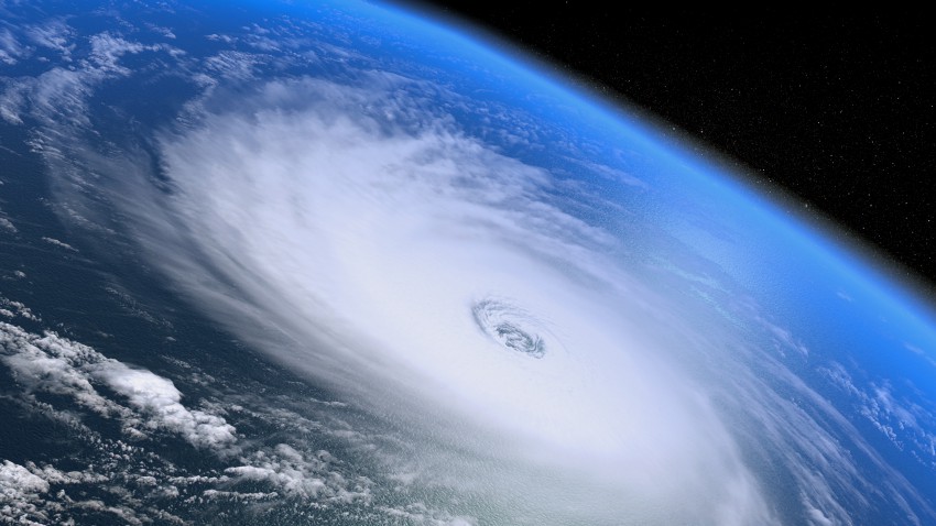
On the heels of the tenth anniversary of Hurricane Katrina’s devastating landfall along the Central Gulf of Mexico, on Monday, August 31st, we recorded a first in the hundred-or-so year history of reliable tropical cyclone tracking: three major hurricanes moving simultaneously across the Pacific. Fortunately this awe-inspiring moment was of mostly academic interest since none of the three storms posed a significant threat to any populated land masses, but it was certainly an intimidating sight on satellite imagery. Couple that with Fred becoming the first hurricane to move through the Cape Verde Islands in the far eastern Atlantic since 1892, and it might be tempting to look for a larger causal force behind a perceived growing tropical cyclone threat, such as everybody’s favorite climatic boogeyman, man-made global warming. However, there’s actually a much more direct correlation between cycles of hurricane frequency, especially in the Eastern Pacific and Atlantic tropical basins, and the warm phase of the ENSO (El Nino Southern Oscillation).
We’re currently in the midst of the strongest El Nino since 1997, a year that was characterized by a very active hurricane season in the Eastern Pacific and, by contrast, a quiet season in the Atlantic basin. Hurricane Linda became the strongest cyclone ever in the Eastern Pacific basin on September 12, 1997, while a couple of weeks later Nora became only the third cyclone ever to survive as a tropical storm all the way up into Arizona. By contrast, the Atlantic basin only saw 7 named storms during the entire 1997 season, including none in August, the only “dry” August on the record since 1961. This year sea surface temperatures (SSTs) are running 1-2˚ C above normal across the Central and Eastern Pacific, with some areas as much 3-4˚ C above. Ignacio became the 5th storm of the season to threaten the Hawaiian Islands, normally too far north and west to be in the line of fire. Ignacio is one of five major hurricanes so far in the Eastern Pacific with the climatological peak of the hurricane season only just passed. Only six storms have even been named at all thus far on the Atlantic side, where the increased vertical wind shear characteristic of a strong El Nino has been poisonous to tropical cyclone development.
So is there any connection between our warming atmosphere and cyclone development? Long-term historical studies don’t reveal any discernible change in hurricane frequency over the last 100 years despite a clearly established trend of increasing temperatures, and climate models that predict a continued rise in temperatures don’t foretell a corresponding increase in the frequency of hurricane development on the global scale. In fact, one thing the climate models do suggest is an increasing frequency of extreme El Nino events that might tend, somewhat paradoxically, to reduce the overall threat for Atlantic hurricanes, despite the rising SSTs. Decade-long breaks such as the one we’re enjoying now between landfalls of major hurricanes on the U.S. mainland might become the rule rather than the exception.
However, the picture is less rosy for other tropical cyclone hotspots across the world, if the model-predicted temperature increases come to pass. While apocalyptic visions of 500-mph supercanes rampaging across the major tropical basins are inaccurate and unhelpful, all things being equal, the plain fact is that warmer SSTs mean better fuel for tropical cyclones. This is especially pertinent when warming SSTs allow an expanded breeding ground for cyclones to threaten coastal areas historically unused to dealing with them. Rising sea levels will also exacerbate the effects of storm surge, the most deadly hazard accompanying most landfalling hurricanes. There may be more telling factors to consider when trying to forecast hurricane activity on a seasonal basis, but leave room for increased hurricane intensity on the list of ambiguous yet consequential impacts of global warming.