NEWS FROM MORECAST
More Catastrophic Flooding in South-Central Texas!
It’s been a year since sudden, catastrophic flooding killed 139 in the Hill Country west of San Antonio, Texas. That death toll included dozens of young girls at Camp Mystic in Kerr County. Now another round of stationary storms and torrential rainfall has pushed rivers to new record levels. Hundreds have been forced to evacuate or have needed emergency rescues.
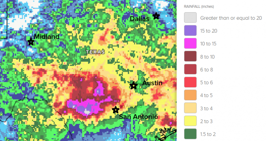
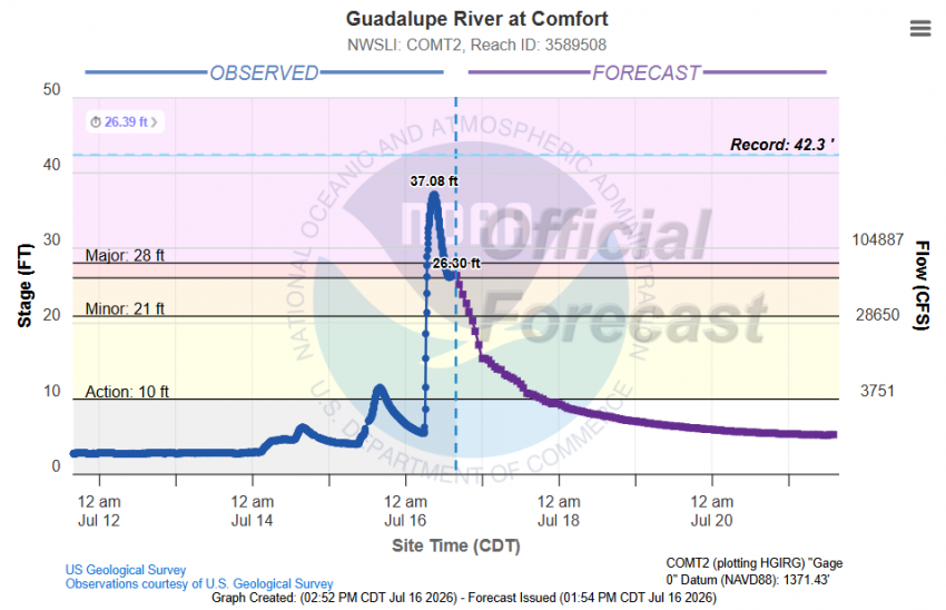
The latest flood disaster began with heavy rains on Tuesday. A severe supercell on the leading edge of the rain mass spawned a tornado over the city of San Antonio on Wednesday (see video above). Rainfall amounts locally over 20 inches (500 mm) have been recorded in the past three days (see map above). Rates have exceeded 2″/hr (50 mm/hr) at times. This multi-day deluge has pushed several rivers into major flood stage, inundating farmland and houses throughout the region. Some of these rivers have seen or will see new record crests, even surpassing the level of the historic July 2025 flood event. The Guadalupe River rose 30 feet (9 m) in just two hours this morning (see graphic below). The Pedernales crested tonight over 34 feet (10.4 m), the highest peak since 1979. Fortunately, new warning systems and protocols have been installed since last year’s devastating floods. Despite the rapid and historic river rises, only one fatality has thus far been blamed on the current flooding.